1
2
3
4
5
6
7
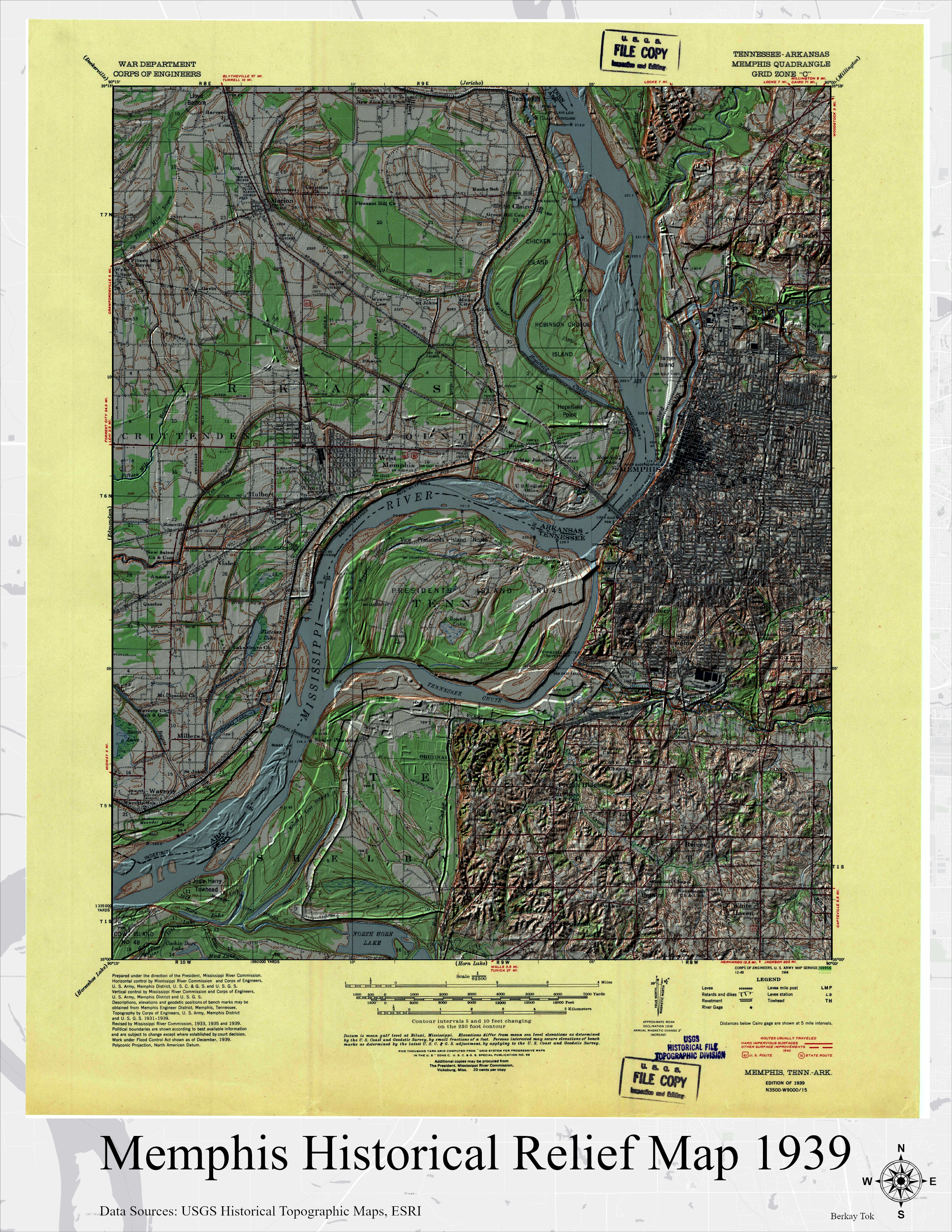
Memphis Historical Relief Map 1939
Berkay Tok, University of Memphis
Creating historical relief maps is a niche practice in the intersection of Geographical Information Systems (GIS), cartography and fine arts. This map has been created in order to understand the process of creating vintage/historical relief maps. Historical map of Memphis and surrounding areas is obtained from USGS Topographical Maps portal (https://ngmdb.usgs.gov/topoview/) and elevation data is obtained from ESRI's Living Atlas. Next steps for this project are to bring the project into a 3D software to use rayshading to create shadows and print on a fine art quality large format printer. Original resolution of the file is 13200 by 10200 and the size shrunk to a smaller size for the contest.
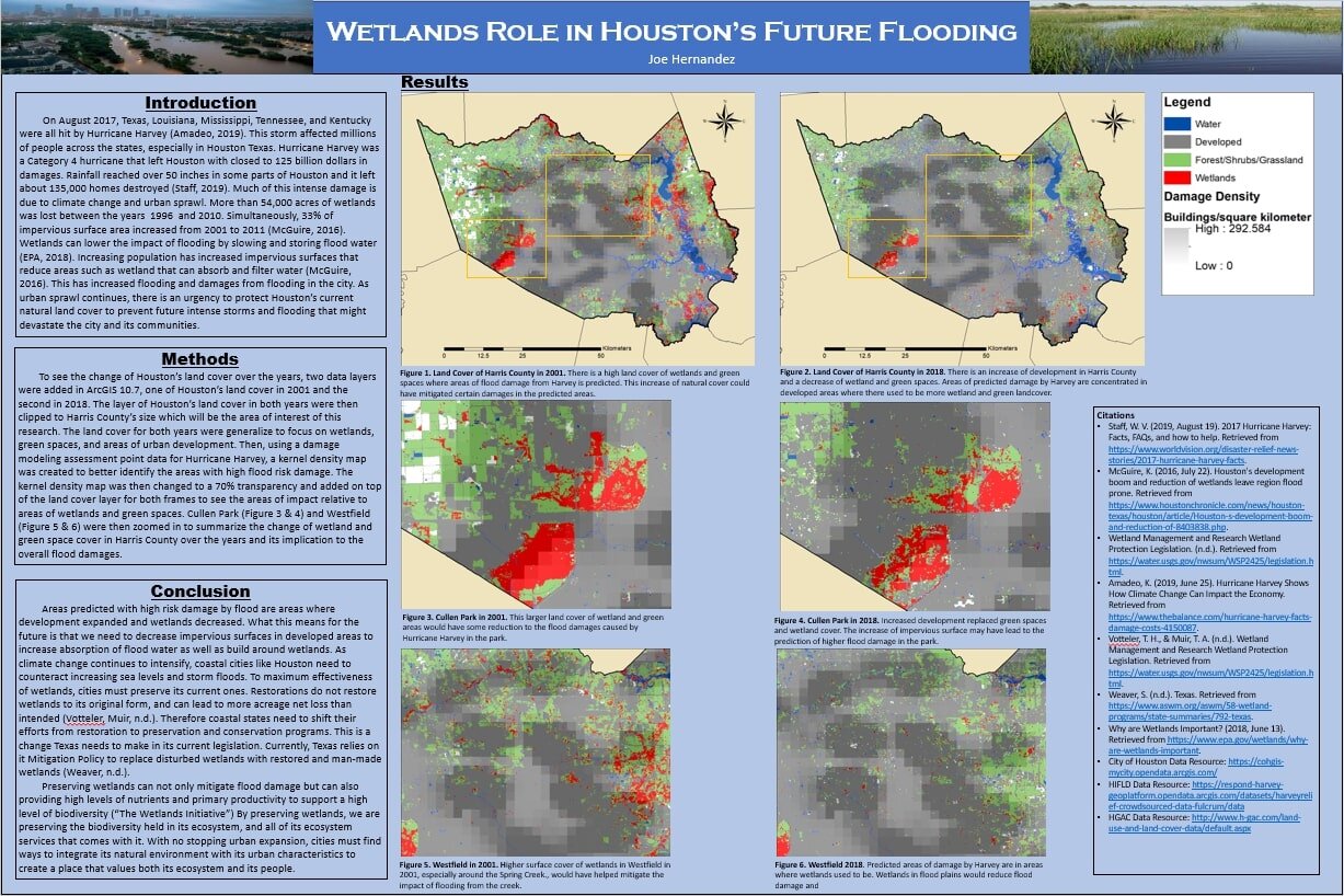
Wetlands Role in Houston's Future Flooding
Joe Hernandez, Rhodes College
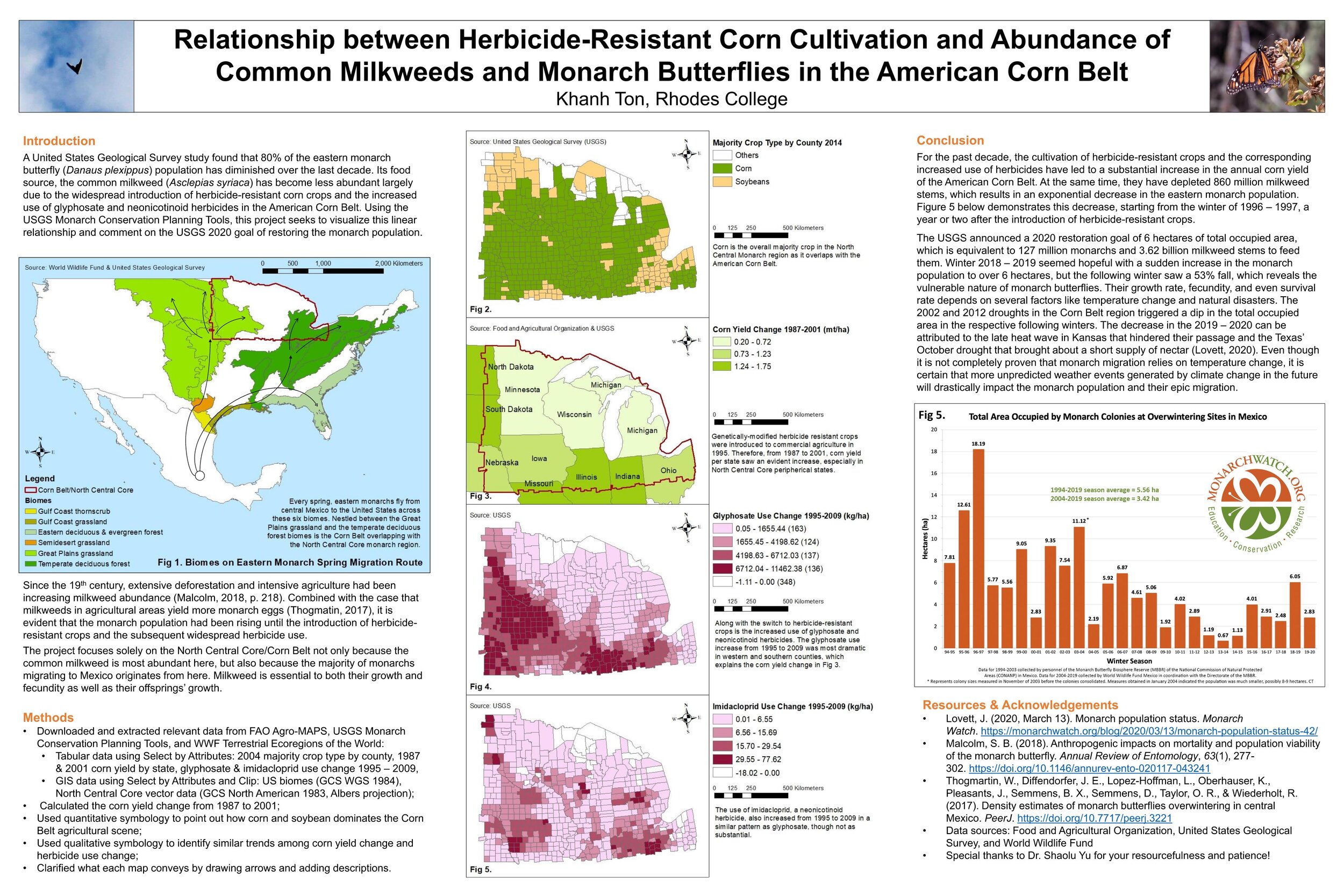
Relationship between Herbicide-Resistant Corn Cultivation and Abundance of Common Milkweeds and Monarch Butterflies in the American Corn Belt
Khanh Ton, Rhodes College
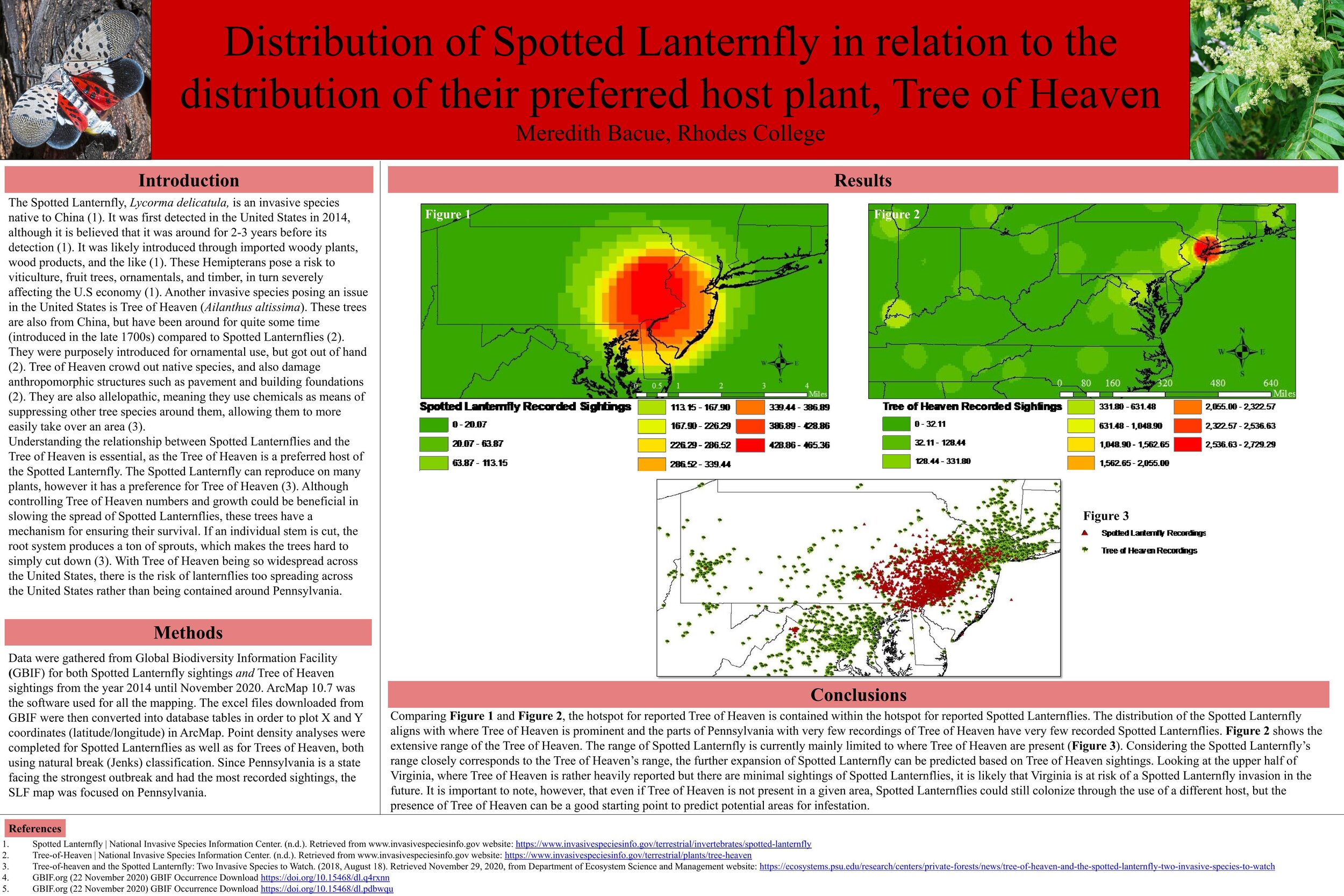
Distribution of Spotted Lanternfly in relation to the distribution of their preferred host plant, Tree of Heaven
Meredith Bacue, Rhodes College
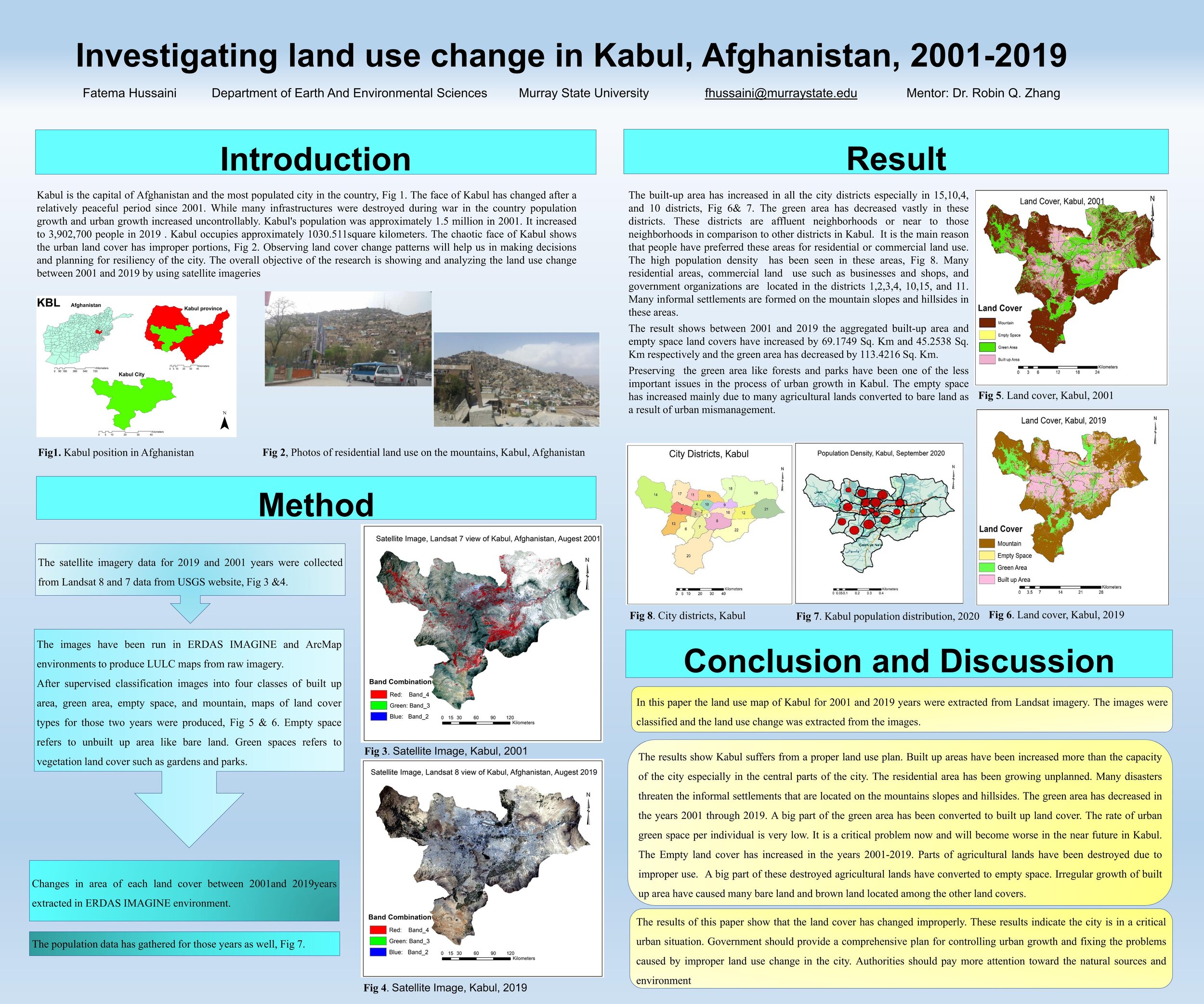
Investigating land use change in Kabul, Afghanistan, 2001-2019
Fatema Hussaini, Murray State University
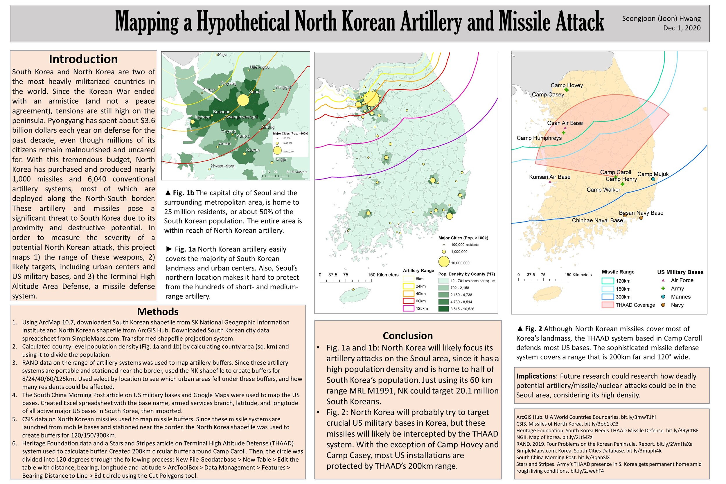
Mapping a Hypothetical North Korean Artillery and Missile Attack
Seongjoon (Joon) Hwang, Rhodes College
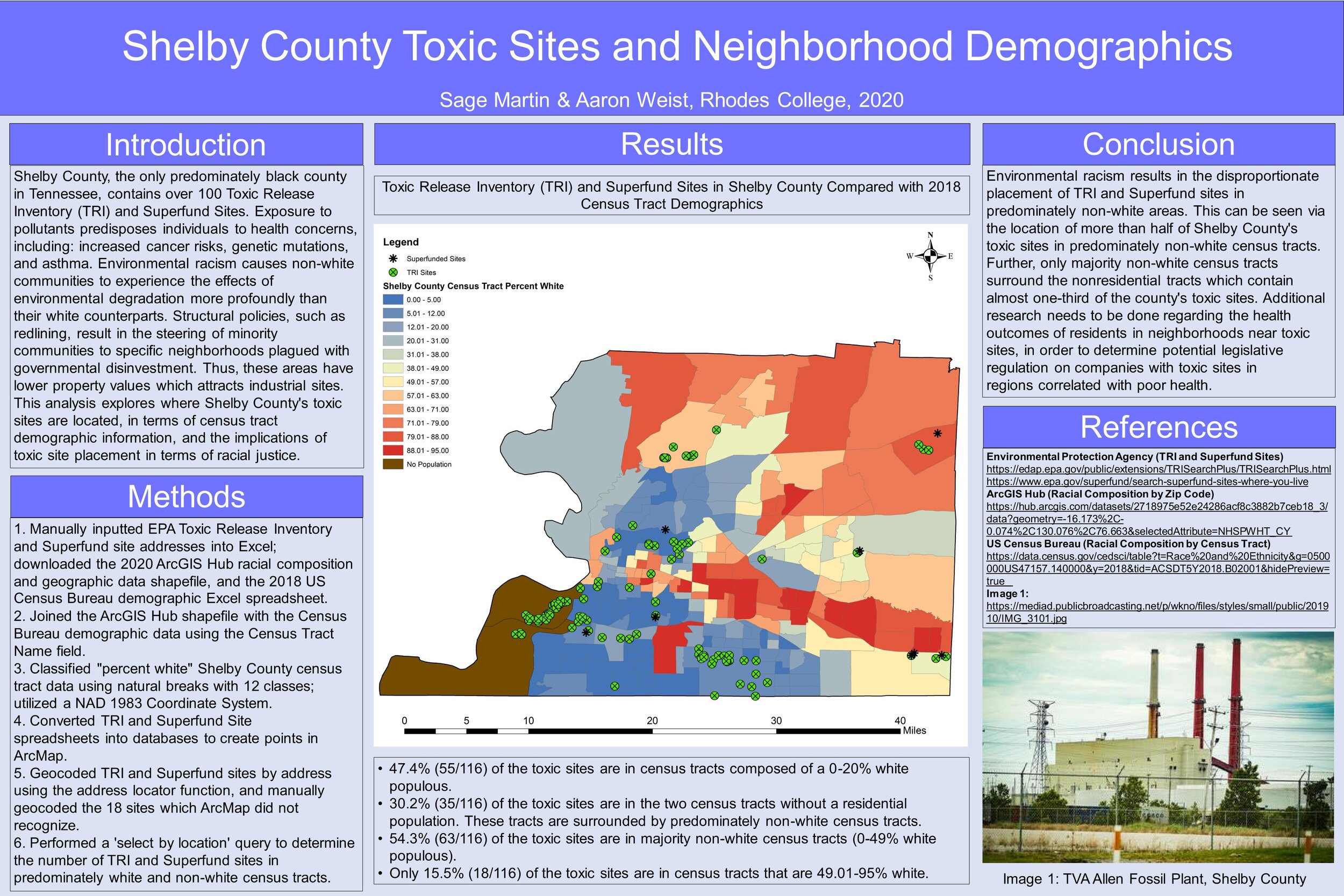
Shelby County Toxic Sites and Neighborhood Demographics
Sage Martin & Aaron Weist, Rhodes College
Email us at magicmemphis@gmail.com
If not stated otherwise, all content is licensed under Creative Commons Zero (CC0) license.